Embrace the wonder of nature as you explore the dirt trails and breath-taking scenery of the Queanbeyan-Palerang region. These 5 great hikes offer something for everyone, with one thing in common – you must be willing to move your legs!
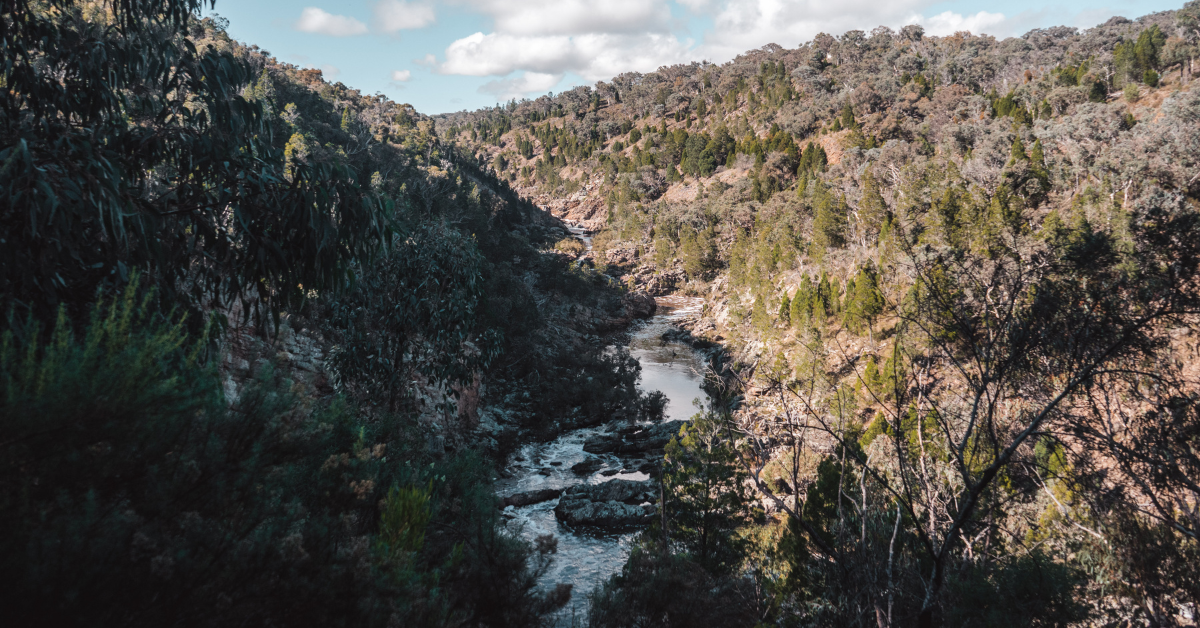
Molonglo Gorge
The spectacular Molonglo Gorge near Queanbeyan features a riverside hike (Blue Tiles Walk) where you can watch the local birdlife and listen to the hum and rush of the Molonglo River. The Gorge showcases cliffs of up to 60 metres in height, making for an imposing presence as you walk the rocky landscape.
Some parts of the hike are narrow and uneven, so watch your step. There are also a few sharp drops to be mindful of, and stairs to help you climb some of the steeper hills.
Along the way, you can see remnants of old homesteads and take a rest at the small picnic spot.
How to get there: Take Sutton Road off Pialligo Avenue and turn onto the dirt road for Kowen Forest and Molonglo Gorge.
Top tip: Don’t drink from the river as it has a high mineral content due to mining in the area.
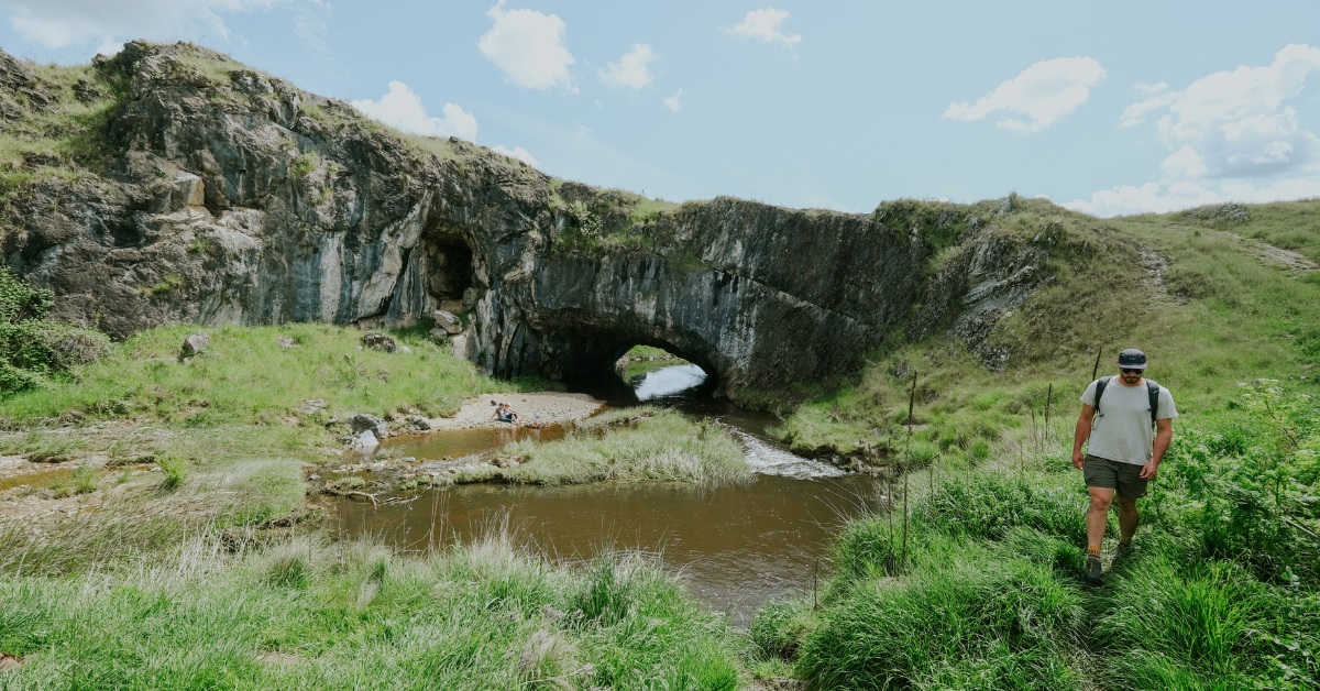
Googong Foreshores
Not only is the Googong Dam and Reservoir a large water source for the ACT, the Googong Foreshores just south of Queanbeyan has plenty to see and do. There are special wetland bird-watching opportunities, with the area being known for 165 bird species, including eagles which gracefully ride the thermals.
In the southern part towards Burra, you can walk to the London Bridge Arch, a natural limestone bridge formed over thousands of years of natural water flow. The London Bridge Walk is 3.4 km return.
To the north, you’ll come across the dam and boating facilities. You can try the Black Wallaby Loop Track (about 2.6 km return) for special views, gullies and the Cascades river gorge. Or a longer option is the 4 km return Shoreline Walk where you might be lucky enough to see trout or waterbirds in the shallows.
For mountain bike enthusiasts, take on the Googong Dam Circuit, with its challenging sharp climbs and rocky surfaces.
How to get there: Take Googong Dam Road to reach the northern section, or Burra Road off Old Cooma Road and turn onto London Bridge Road to reach the southern section.
Top tip: Googong Foreshores is gated and only open in daylight hours. It is closed on Christmas Day.
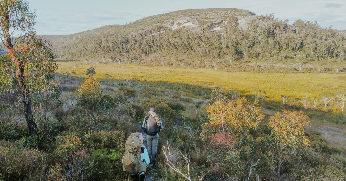
Mount Budawang
Budawang National Park is named for its lofty summit, Mount Budawang, which is a variation of the Aboriginal word ‘Buddawong’. To hike to the peak is a challenging 8 km return feat for experienced bushwalkers. Take the Mount Budawang Trail and allow a full day to traverse the forest wilderness. The ascent is 430 metres up the side of the mountain, though we’re told it’s all worth it when you take in the 360-degree views as you catch your breath!
Keep in mind, not all parts of this trail are well signposted, so we recommend you explore with an experienced hiker. Print a topographic map and take a compass as mobile coverage may not be available.
How to get there: Drive down Charleys Forest Road for about half an hour before turning onto Budawang Road.
Top tip: Take plenty of water with you and check the weather forecast.
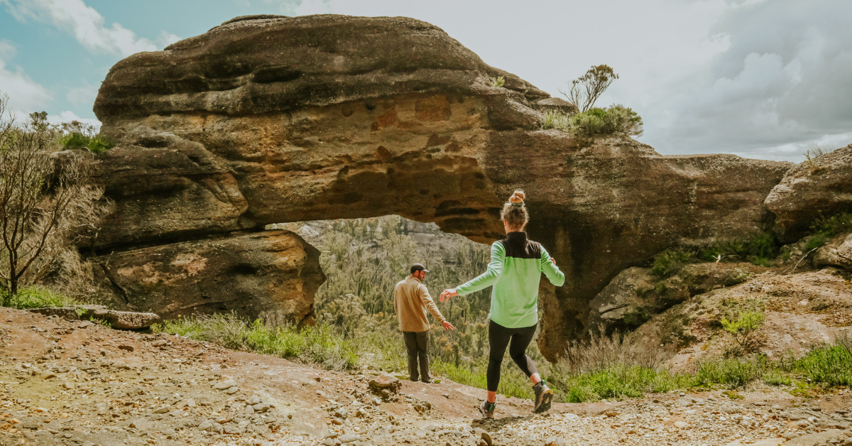
Corang Arch
Wog Wog is a small locality south of Corang River about 34 km north of Braidwood. It is mainly known for being on the edge of Budawang National Park. The Wog Wog campground is a great option for those looking to explore the area over a few days.
The beautiful scenic rim ‘out-and-back’ trail is where you can see Corang Arch, which is a sandstone rock formation on a cliff edge. Along the 26.4 km, you’ll find many lookouts, including the summit at Corang Peak.
Consider pairing with an experienced bushwalker as this track doesn’t have many signs and the trail can have overgrowth. Print a topographic map and take a compass as mobile coverage may not be available.
How to get there: From Braidwood, take Little River Road to Charleys Forest Road, then follow this until you reach the Wog Wog campground.
Top tip: Make it an overnight hike by camping near the arch at Canowie Brook Campsite or Burrumbeet Brook Campsite.
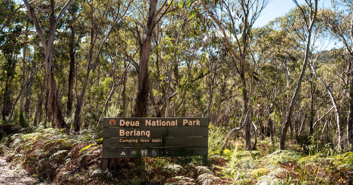
The Big Hole
The vast open chasm called ‘The Big Hole’ is a roofless limestone cave. It is thought to be 400 million years old! The view is impressive as you stare into the 100-metre-deep and 50-metre-wide cave. To get there, take The Big Hole Walking Track from the Berlang campground and hike your way to the viewing platform.
Along the way, you may need to get your feet wet as you cross the Shoalhaven River – it’s refreshing in summer and freezing in winter. Take caution during periods of rain as the water levels may become too deep or fast flowing to cross. Also expect a climb up to the ridge to reach the viewing platform; it’s worth it!
How to get there: From Braidwood, turn onto Cooma Road from Araluen Road. Follow until you reach Berlang campground.
Top tip: The rocks can be very slippery, so take care!
Written by Shae Lalor, The Write Path, for Visit Queanbeyan-Palerang.